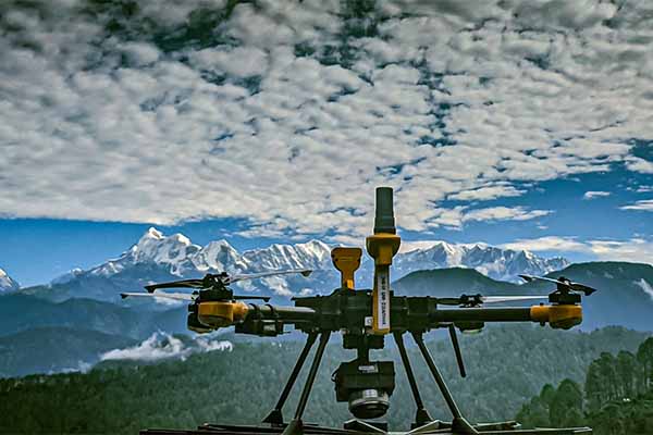
Government of India is using drones for mapping Abadi region. So, what was the problem? Land records in India were created by the Britishers. To digitise existing rural land records, the central government launched the Digital India Land Record Modernization Programme (DILRMP). The major hurdle in the implementation of the scheme was the land records of residential properties. The Britishers never created land records for the residential properties. It was the agricultural land from where they were generating revenue so they ignored the residential properties. Further, the DILRMP scheme did not involve the surveying of Abadi areas. So, there was no data available for the residential properties. Abadi areas refer to unplanned settlements in rural areas where development control regulations do not apply.
The land is a necessary resource for any economic activity that seeks to create material prosperity. The lack of a clearly defined Abadi region has resulted in a significant number of land-conflict lawsuits. According to studies, land conflicts affect millions of people in India and around the world.
SVAMITVA:
To solve this problem, the SVAMITVA (Survey of villages and mapping with improvised technology in village areas) scheme was started. The scheme is for surveying the land parcels in the rural inhabited area using Drone technology.
The survey shall be done across the country in a phase-wise manner over the period 2020-2025. It aims to provide rural people with the right to document their residential properties so that they can use their property for economic purposes.
For the scheme, mapping of the Abadi areas can be done using many methods. The easy one, which does not involve the use of any complicated technology, is by sending people on the ground to figure out the boundaries of every plot manually. But this is a costly and time taking process with no means to verify whether the data is collected at the corner of the boundary or sitting inside a room. This is also a costly affair as it involves significant manpower and time. Another method could be the use of satellite imagery which offers 150 centimeters per pixel in India. This resolution can lead to an error in the position of any point on the ground. Whereas drones offer a resolution of 3 centimeters per pixel thus minimising the error. So, that is why for more accurate results drones are used under the scheme.
Drones:

Drones are used for imagining the property and once the imaging is done, the boundaries are demarcated in the image. Aereo is one of the drone startups which is partnering with the government in the implementation of the SVAMITVA scheme. The company was co-founded by Vipul Singh in 2013 from IIT Kanpur. Explaining the process of demarcating the boundary Vipul says, “While we are concerned with creating maps using drones, there are government officials who go on the ground, make the first boundary based on their records, and get it verified by the owner and their neighbour and only when these people agree to that boundary, without any dispute, officials mark that boundary. Otherwise, the whole boundary or the whole land is marked as disputed. And then they are given chances to rectify their boundary disputes.”
The land is a state subject in the constitution of India. The scheme, formulated by the centre, is being implemented, on-ground, by state governments. Vipul says, “The central government has a fixed set of SOPs. With the learnings and evolution, these SOPs are also updated. This is nothing rigid but at a time there is a single SOP that is being followed almost everywhere in the country when it comes to the creation of the first layer of the map.”
After that how will they go to the field to get the verification done? Vipul says, “Every state has a slight variation in its approach because different people and different states have different approaches to conducting the project,” he added.
Projects:
Aereo has deployed its drones in Maharashtra and Rajasthan and Chhattisgarh. In the past, they have mapped villages in Uttarakhand, Uttar Pradesh, Madhya Pradesh and around the Delhi region. They have covered nearly 35,000 villages already and more are getting covered every day.
Vipul says, “in Haryana, we are doing large-scale mapping which is, basically, complete state mapping. We have already covered 20,000 square kilometers out of the 32,000 square kilometers which were awarded to us.”
The schemes, at the scale of SVAMITVA, are usually marred with challenges. Highlighting some of the challenges in the implementation of the scheme, Vipul says, “it is a new technology. Everyone is learning. Even the government machinery is, for the first time, using this technology. So, there are a lot of gaps in the understanding of how this technology works.”
Some of the challenges related to the scheme include knowledge about the right quality which should be expected, criteria to select the vendor, parameters to finalize a good performing vendor, the training required and the skilling required for handling the data. Vipul says, “central agencies like Survey of India and Ministry of Panchayati Raj are well versed (on this) compared to the state government machinery. So, there is a need for a lot of sensitization and awareness in the state government so that they can look at handling the data better.”


